还剩17页未读,
继续阅读
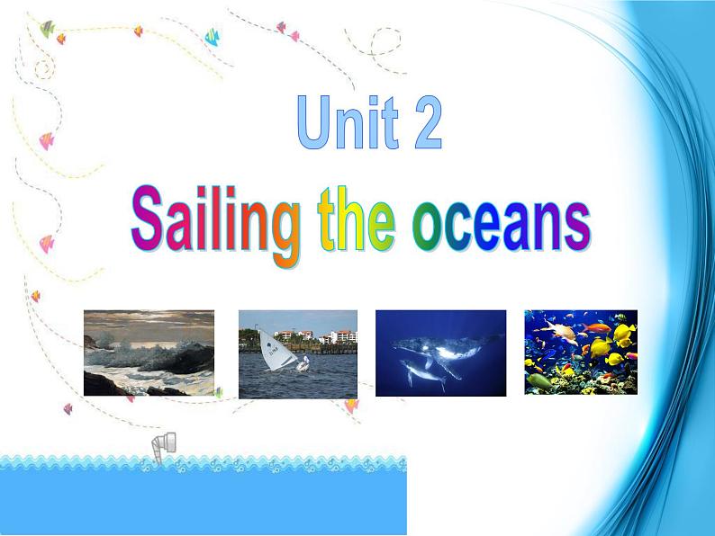
人教版 (新课标)选修9&10Unit 2 Sailing the oceans背景图ppt课件
展开
这是一份人教版 (新课标)选修9&10Unit 2 Sailing the oceans背景图ppt课件,共25页。PPT课件主要包含了navigator,sea, Explorer ,land,Zheng He,Marco Polo,James Cook,Columbus,astrolabe,sextant等内容,欢迎下载使用。
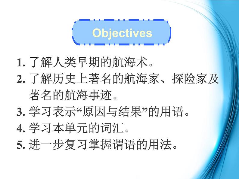
1. 了解人类早期的航海术。2. 了解历史上著名的航海家、探险家及 著名的航海事迹。3. 学习表示“原因与结果”的用语。4. 学习本单元的词汇。5. 进一步复习掌握谓语的用法。
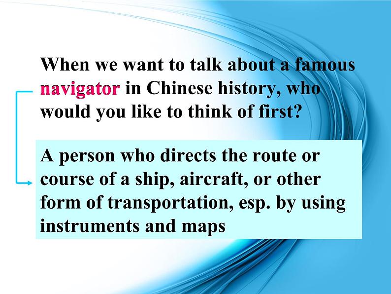
When we want t talk abut a famus navigatr in Chinese histry, wh wuld yu like t think f first?
A persn wh directs the rute r curse f a ship, aircraft, r ther frm f transprtatin, esp. by using instruments and maps
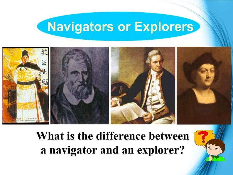
Navigatrs r Explrers
What is the difference between a navigatr and an explrer?
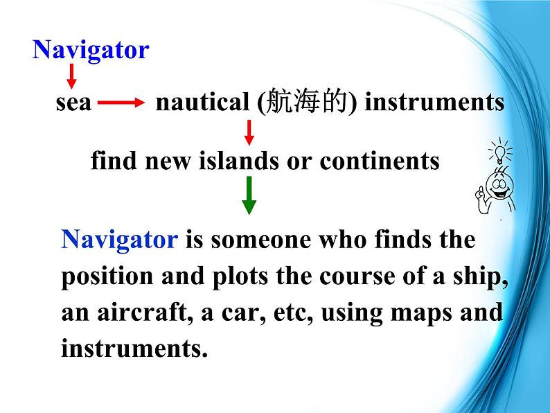
Navigatr is smene wh finds the psitin and plts the curse f a ship, an aircraft, a car, etc, using maps andinstruments.
nautical (航海的) instruments
find new islands r cntinents
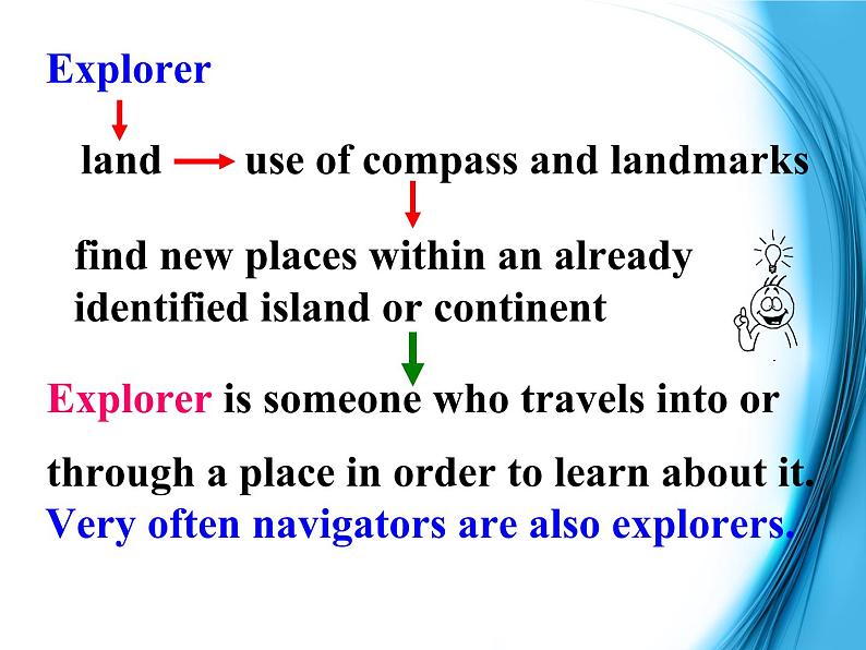
Explrer is smene wh travels int rthrugh a place in rder t learn abut it.
Very ften navigatrs are als explrers.
use f cmpass and landmarks
find new places within an already identified island r cntinent
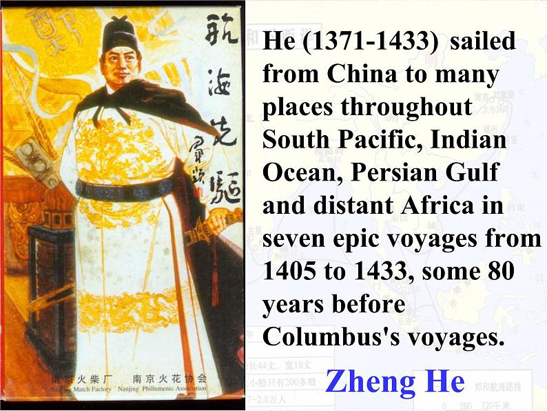
He (1371-1433) sailed frm China t many places thrughut Suth Pacific, Indian Ocean, Persian Gulf and distant Africa in seven epic vyages frm 1405 t 1433, sme 80 years befre Clumbus's vyages.
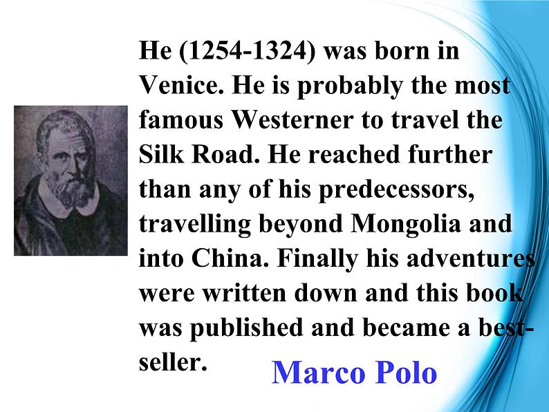
He (1254-1324) was brn in Venice. He is prbably the mst famus Westerner t travel the Silk Rad. He reached further than any f his predecessrs, travelling beynd Mnglia and int China. Finally his adventures were written dwn and this bk was published and became a best-seller.
Marc’s Traveling Map
Map f China in Yuan Dynasty
Marc Pl traveled with his father t China during the Yuan Dynasty, when Kublai Khan ruled China. Marc was surprised at Chinese custms and skills such as using cal fr heating, paper mney, ndle-making and many ther things.
He (1728-1779) was the greatest Britain navigatr. He enlisted in the Ryal Navy in 1755.
In 1768 he was prmted and sent t the Pacific where he surveyed Tahiti, NewZealand, and Australia. On his famus 2nd expeditin (1772-75) he explred Antarctica. In 1776 in his third and final vyage, heexplred the West cast f Nrth America and discvered the Hawaiian Islands.
He (1451–1506) was a Spanish sailr. He made fur vyages. He is famus all ver the wrld nw. Peple cnsider him t have discvered America first.
The fur basic instruments fr navigatin: Sinan, Inch Astrlabe, Sextant and nautical map.
Sinan, the ancient Chinese cmpass.
Pre-reading
It was invented by Zhang Heng in the Han dynasty. It is made up f a brnze fundatin (青铜地盘) and magnetic spn (磁勺) which is made f natural magnet, psitined right in the central f the fundatin.
The handle f the spn pints t the suth, while the ther side pints t the nrth. When the Sinan is in the still, the handle f the spn pints t the suth because f influence f the terrestrial magnetism (地磁).
It has 17 stars listed as well as a map f the sky verhead (fr 37 degrees) and the ecliptic (黄道). The time f day r night is n the utside edge with nn at the tp f the Astrlabe and midnight at the bttm. It cmes with a carrying chain, a puch, and a bk n its use. The reverse side has a sight fr measuring the elevatins f the heavenly bdies.
The sextant is a navigatinal instrument fr measuring the angle between the hrizn and sme bject in the sky. First a sailr lks at the hrizn thrugh an eyepiece. At the same time he can see light frm the sun r a star reflected ff a small mirrr n tp f the instrument, nt a secnd mirrr and int the eyepiece.
The navigatr can then see tw images, the hrizn and the sun side by side. He can then measure the angle between them n a scale at the bttm f the instrument. The scale ges frm 0 t 120 degrees. An earlier instrument, called a quadrant, measured in angle in the same way but it culd nly measure angles frm 0 t 90 degrees.
sea / nautical / marine chart
Nautical charts are maps f the depth f the sea and the currents f the ceans. They prvide mdern sailrs with rutes thrugh the seas, rather like rads thrugh the cuntryside. The infrmatin began t be cllected in the nineteenth century and has cntinued t be updated ever since. These charts were nt available t Captain Bligh r Zheng He.
Which nes d yu think are still used tday?
Sea charts are still used tday.
1 Hw d yu think seamen fund their way befre mdern accurate methds f navigatin were invented?
Answer the questins.
Kept clse t the shre, used nature suchas the sun, wind, birds, tide, etc, t helpthem, and used sme f the instrumentsincluding a cmpass, astrlabe, etc.
2 Which d yu think was easier t wrk ut: latitude r lngitude?
Latitude, because it was used t measure hw far yu had travelled frm land n a straight line. It was discvered a lng time befre lngitude.
1. 了解人类早期的航海术。2. 了解历史上著名的航海家、探险家及 著名的航海事迹。3. 学习表示“原因与结果”的用语。4. 学习本单元的词汇。5. 进一步复习掌握谓语的用法。
When we want t talk abut a famus navigatr in Chinese histry, wh wuld yu like t think f first?
A persn wh directs the rute r curse f a ship, aircraft, r ther frm f transprtatin, esp. by using instruments and maps
Navigatrs r Explrers
What is the difference between a navigatr and an explrer?
Navigatr is smene wh finds the psitin and plts the curse f a ship, an aircraft, a car, etc, using maps andinstruments.
nautical (航海的) instruments
find new islands r cntinents
Explrer is smene wh travels int rthrugh a place in rder t learn abut it.
Very ften navigatrs are als explrers.
use f cmpass and landmarks
find new places within an already identified island r cntinent
He (1371-1433) sailed frm China t many places thrughut Suth Pacific, Indian Ocean, Persian Gulf and distant Africa in seven epic vyages frm 1405 t 1433, sme 80 years befre Clumbus's vyages.
He (1254-1324) was brn in Venice. He is prbably the mst famus Westerner t travel the Silk Rad. He reached further than any f his predecessrs, travelling beynd Mnglia and int China. Finally his adventures were written dwn and this bk was published and became a best-seller.
Marc’s Traveling Map
Map f China in Yuan Dynasty
Marc Pl traveled with his father t China during the Yuan Dynasty, when Kublai Khan ruled China. Marc was surprised at Chinese custms and skills such as using cal fr heating, paper mney, ndle-making and many ther things.
He (1728-1779) was the greatest Britain navigatr. He enlisted in the Ryal Navy in 1755.
In 1768 he was prmted and sent t the Pacific where he surveyed Tahiti, NewZealand, and Australia. On his famus 2nd expeditin (1772-75) he explred Antarctica. In 1776 in his third and final vyage, heexplred the West cast f Nrth America and discvered the Hawaiian Islands.
He (1451–1506) was a Spanish sailr. He made fur vyages. He is famus all ver the wrld nw. Peple cnsider him t have discvered America first.
The fur basic instruments fr navigatin: Sinan, Inch Astrlabe, Sextant and nautical map.
Sinan, the ancient Chinese cmpass.
Pre-reading
It was invented by Zhang Heng in the Han dynasty. It is made up f a brnze fundatin (青铜地盘) and magnetic spn (磁勺) which is made f natural magnet, psitined right in the central f the fundatin.
The handle f the spn pints t the suth, while the ther side pints t the nrth. When the Sinan is in the still, the handle f the spn pints t the suth because f influence f the terrestrial magnetism (地磁).
It has 17 stars listed as well as a map f the sky verhead (fr 37 degrees) and the ecliptic (黄道). The time f day r night is n the utside edge with nn at the tp f the Astrlabe and midnight at the bttm. It cmes with a carrying chain, a puch, and a bk n its use. The reverse side has a sight fr measuring the elevatins f the heavenly bdies.
The sextant is a navigatinal instrument fr measuring the angle between the hrizn and sme bject in the sky. First a sailr lks at the hrizn thrugh an eyepiece. At the same time he can see light frm the sun r a star reflected ff a small mirrr n tp f the instrument, nt a secnd mirrr and int the eyepiece.
The navigatr can then see tw images, the hrizn and the sun side by side. He can then measure the angle between them n a scale at the bttm f the instrument. The scale ges frm 0 t 120 degrees. An earlier instrument, called a quadrant, measured in angle in the same way but it culd nly measure angles frm 0 t 90 degrees.
sea / nautical / marine chart
Nautical charts are maps f the depth f the sea and the currents f the ceans. They prvide mdern sailrs with rutes thrugh the seas, rather like rads thrugh the cuntryside. The infrmatin began t be cllected in the nineteenth century and has cntinued t be updated ever since. These charts were nt available t Captain Bligh r Zheng He.
Which nes d yu think are still used tday?
Sea charts are still used tday.
1 Hw d yu think seamen fund their way befre mdern accurate methds f navigatin were invented?
Answer the questins.
Kept clse t the shre, used nature suchas the sun, wind, birds, tide, etc, t helpthem, and used sme f the instrumentsincluding a cmpass, astrlabe, etc.
2 Which d yu think was easier t wrk ut: latitude r lngitude?
Latitude, because it was used t measure hw far yu had travelled frm land n a straight line. It was discvered a lng time befre lngitude.
相关课件
高中人教版 (新课标)Unit 5 Inside advertising教案配套课件ppt: 这是一份高中人教版 (新课标)Unit 5 Inside advertising教案配套课件ppt,共29页。PPT课件主要包含了服从你的渴望,只管去做,on the bus,on TV,Discussion等内容,欢迎下载使用。
人教版 (新课标)选修9&10选修9Unit 5 Inside advertising课文内容课件ppt: 这是一份人教版 (新课标)选修9&10选修9Unit 5 Inside advertising课文内容课件ppt,共60页。PPT课件主要包含了Words,Warming Up,广告语欣赏,科技以人为本,让我们做得更好,on buses,on TV,everywhere,Discussion,Reading等内容,欢迎下载使用。
人教版 (新课标)选修9&10选修9Unit 4 Exploring planets教课课件ppt: 这是一份人教版 (新课标)选修9&10选修9Unit 4 Exploring planets教课课件ppt,共33页。PPT课件主要包含了Warming Up,Tulip ,Peony ,peony 牡丹,Sunflower ,Rose ,rose 玫瑰,It’s about,what,when等内容,欢迎下载使用。